Welcome to our comprehensive guide on exploring historical imagery in Google Earth Pro. If you’re looking to dive into the past and uncover the fascinating changes our world has undergone, you’re in the right place. In this article, we will walk you through the steps to access and utilize the historical imagery feature in Google Earth Pro, enabling you to witness the evolution of various locations over time.
Introduction to Google Earth Pro’s Historical Imagery
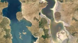
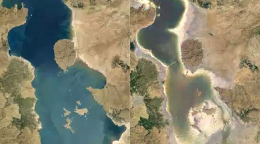
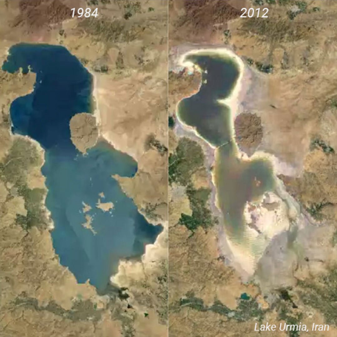
Google Earth Pro offers an exceptional tool for visualizing the changes that have occurred across the globe. This feature provides users with a unique opportunity to travel back in time and observe historical satellite imagery, offering insights into urban development, natural landscape alterations, and much more.
Accessing Historical Imagery
- Open Google Earth Pro: If you don’t already have Google Earth Pro installed, you can download it from the official website. Once installed, launch the application.
- Navigate to Your Desired Location: Use the search bar to find the location you’re interested in exploring historically. You can input the address, landmark, or coordinates.
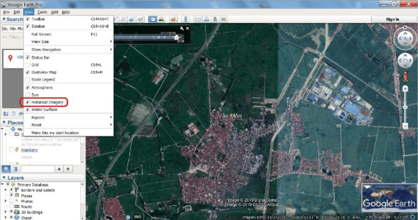
- Enable Historical Imagery: With your location in view, head to the toolbar and click on the “View” tab. From the dropdown menu, select “Historical Imagery.” Alternatively, you can use the shortcut “Ctrl + Alt + T.”
Exploring Historical Imagery
Upon enabling historical imagery, you’ll be presented with a slider that allows you to adjust the timeline. This slider provides a chronological view of available historical images. You can drag the slider to different years and even specific months to witness changes throughout time.
Unveiling the Past
By using the historical imagery feature, you can observe various transformations, including:
- Urban Development: Witness the growth of cities, expansion of infrastructure, and changing architectural landscapes.
- Environmental Changes: Track alterations in forests, lakes, coastlines, and other natural features.
- Land Use Shifts: Observe shifts in agricultural patterns, deforestation, and land reclamation efforts.
Utilizing Historical Imagery
- Comparing Different Dates: To make precise comparisons, use the “Compare” feature. This will overlay two historical images, allowing you to analyze changes side by side.
- Saving and Sharing: If you’ve stumbled upon an interesting snapshot of the past, save it for future reference. Click on the “Save” button to bookmark the specific imagery. You can also share these views with friends and colleagues.
The Power of Historical Context
Understanding historical imagery can provide context for present-day situations and challenges. It can assist urban planners, environmentalists, historians, and researchers in making informed decisions based on past experiences.
Conclusion
Google Earth Pro’s historical imagery feature is an invaluable tool for anyone curious about the changes our world has undergone. By following the simple steps outlined in this guide, you can uncover a wealth of information and gain a deeper appreciation for the dynamic nature of our planet.
Remember, the past holds the key to shaping the future, and Google Earth Pro’s historical imagery feature allows you to unlock that door with ease.
Start exploring the past today with Google Earth Pro’s historical imagery feature, and witness the captivating stories that lie beneath the surface of our ever-changing world.